# Climate Resilience Resources for Cultural Heritage Toolkit
Even before Zillow removed ClimateCheck and FirstStreet risk scores from its site, this [award winning](https://blooloop.com/innovation-awards/2024/project/climate-resilience-resources/) tool was one of the best one-stop resource for climate hazard information for *any property* in the US and Territories. [Here](https://app.resilience.culturalheritage.org/) is the tool. [Here](https://storymaps.arcgis.com/stories/9a756d69c98e4e688196042a9e05a226) is the data behind the tool.
Through the [National Endowment for the Humanities (NEH)](https://www.neh.gov/), [Held in Trust](https://www.culturalheritage.org/about-us/foundation/programs/held-in-trust) program, [Ben Lewis](https://gis.harvard.edu/people/ben-lewis) provided consulting in system design, system architecture, and interface design to the [Foundation for Advancement in Conservation](https://www.culturalheritage.org/). The result is the "Climate Resilience Resources for Cultural Heritage Toolkit" (CRR) available here .
[NEH](https://www.neh.gov/) funded the tool to enable any organization to identify the important risks to a given property or area, in order to enable resiliency planning for that location.
[ 
](https://drive.google.com/file/d/1nNMGEp3IPf55_WSJ0XNLSnX0mUvPt8Tq/) 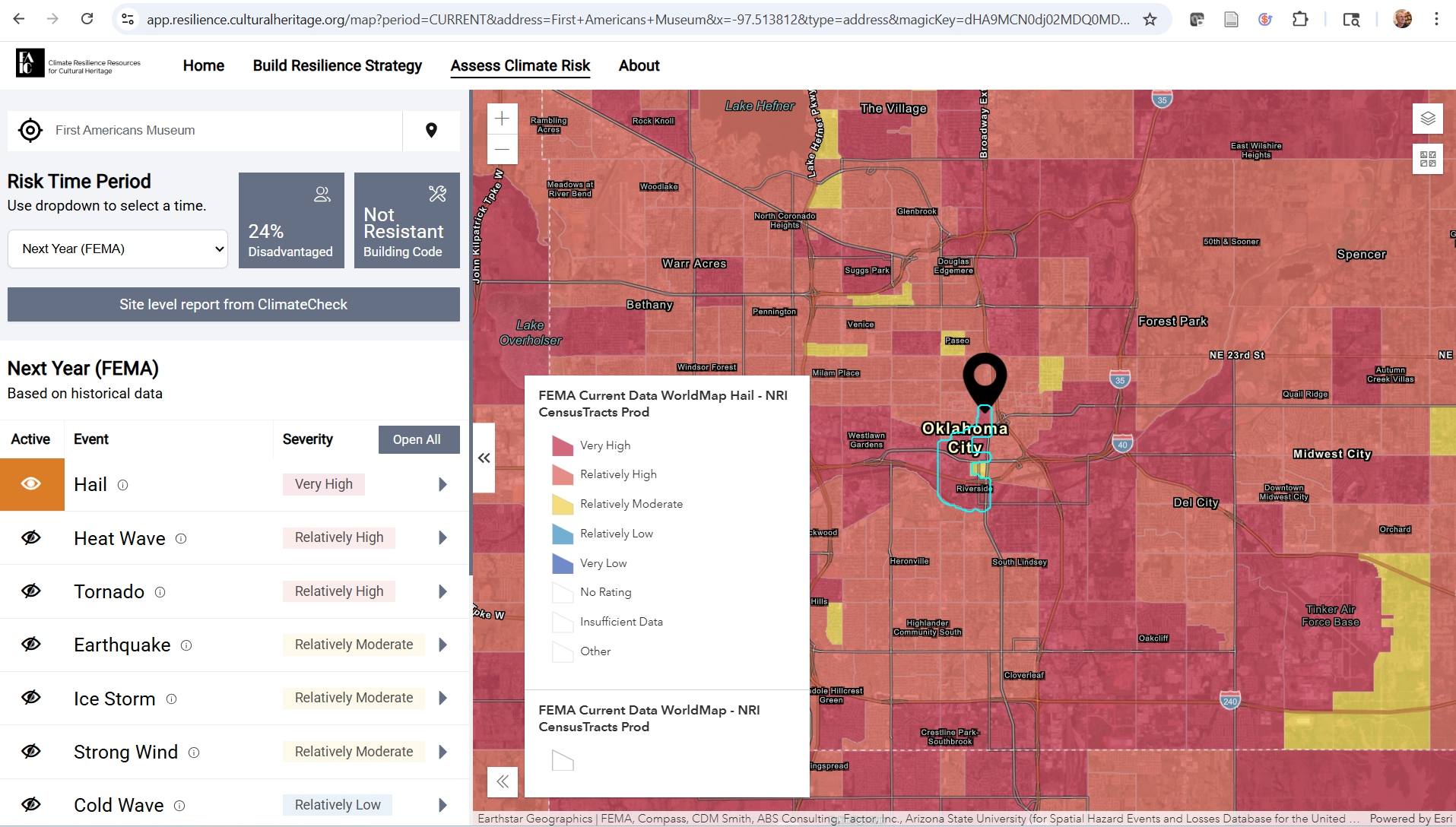
Bringing together best available government and commercial data and models, (NOAA, FEMA, ClimateCheck, and others), the system provides the public with local hazard risk estimates based on authoritiative data, for any part of the United States and Territories.
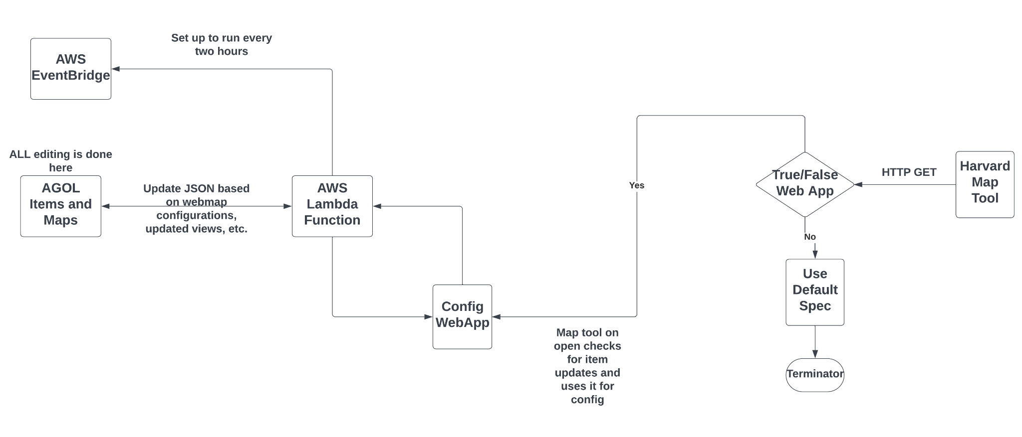
Though the system makes use of many large datasets, the system requires little maintenance and has low hosting costs. This is made possible through an innovative use of Esri Hub, which is free for non-profits, the ArcGIS Platform API, and just-in-time application functionality based on the user's map navigation, provided by a lamda function against hazard data stored in AWS.
**Core Components:**
- ArcGIS Hub Site
- Public DNS:
- ArcGIS URL:
- ArcGIS Online Organizational Content:
- ArcGIS Content:
- Cultural Heritage Climate Risk Application
- Application hosted in FAIC AWS:
- Application JSON update script is hosted in FAIC AWS
The team is working to further refine the system. Please send any comments or suggestions to .
[**Contributing Organizations**](https://www.resilience.culturalheritage.org/pages/about)