# Climate Resilience Resources for Cultural Heritage Toolkit - Phase 1
December 12, 2023
The first phase of the Climate Resilience Resources for Cultural Heritage Toolkit (CRR) is available at . The final version was released in March of 2024.
[**Project Data** ](https://storymaps.arcgis.com/stories/9a756d69c98e4e688196042a9e05a226)
This [National Endowment for the Humanities (NEH)](https://www.neh.gov/)-funded climate-hazard assessment and planning tool is designed to provide organizations tasked with managing cultural heritage in the U.S., with a way to begin to identify important climate hazards for a given place, to support resiliency planning.
[ 
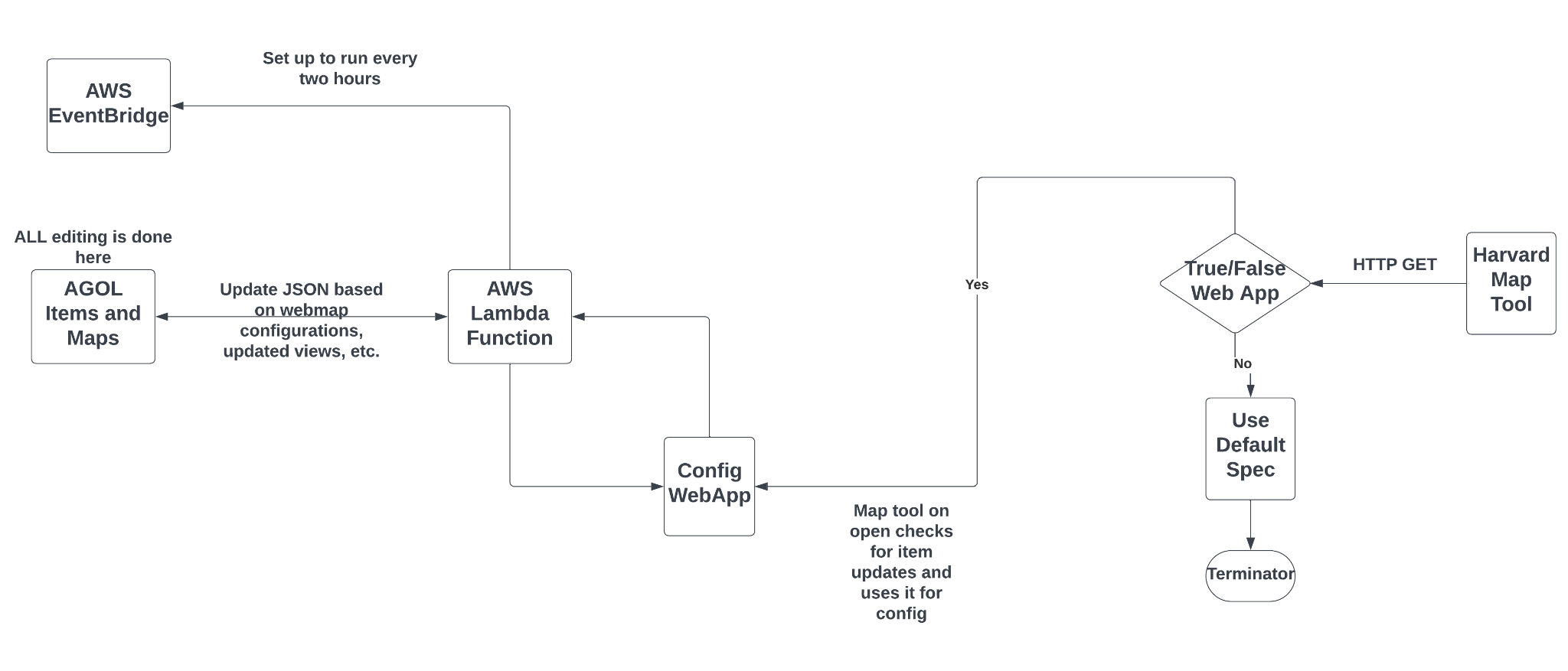
](https://drive.google.com/file/d/1nNMGEp3IPf55_WSJ0XNLSnX0mUvPt8Tq/)Through a [collaboration with NEH](https://www.neh.gov/news/foundation-advancement-conservation-and-national-endowment-humanities-chart-path-future) called [Held in Trust](https://www.culturalheritage.org/about-us/foundation/programs/held-in-trust), (which includes experts from many organizations), the CGA provided consulting in system architecture and UI design to the [Foundation for Advancement in Conservation](https://www.culturalheritage.org/).
Bringing together best available government and commercial data and models, (NOAA, FEMA, ClimateCheck, and others), the system is designed to provide the public with local hazard risk estimates based on authoritiative data, for any part of the United States and Territories.
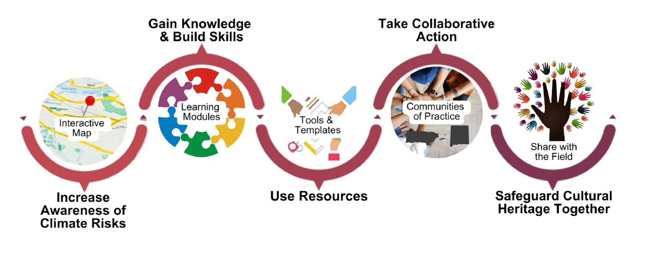
Though the system makes use of many large datasets, the system requires very little maintenance and has low hosting costs. This is made possible through an innovative use of Esri Hub which is free for non-profits, the ArcGIS Platform API, and just-in-time application functionality based on the user's map navigation, provided by a lamda function against hazard data stored in AWS.
**Core Components:**
- ArcGIS Hub Site
- Public DNS:
- ArcGIS URL:
- ArcGIS Online Organizational Content:
- ArcGIS Content:
- Cultural Heritage Climate Risk Application
- Application hosted in FAIC AWS:
- Application JSON update script is hosted in FAIC AWS
The team is working to further refine the system. Please send any comments or suggestions to .
[**Contributing Organizations**](https://www.resilience.culturalheritage.org/pages/about)
Share on:- [ Facebook ](#)
- [ Twitter ](#)
- [ Linkedin ](#)