MOSAIKS: A generalizable and accessible approach to machine learning with global satellite imagery
Date and Time
Location
View the slides from this presentation. A video recording of the presentation is available by contacting the CGA.
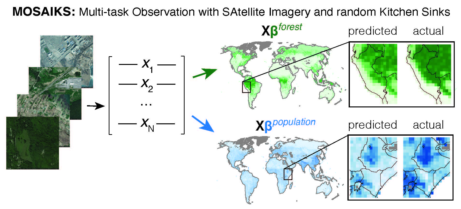
Abstract: Combining satellite imagery with machine learning (SIML) has the potential to address global challenges by remotely estimating socioeconomic and environmental conditions in data-poor regions, yet currently, the resource requirements of SIML limit its accessibility and use for many researchers. In the first part of this talk, I'll show that a single encoding of satellite imagery can generalize across diverse prediction tasks (e.g., forest cover, house price, road length). Our method (MOSAIKS) achieves accuracy competitive with deep neural networks at orders of magnitude lower computational cost, scales globally, and facilitates characterizations of applicability and uncertainty. Since image encodings are shared across tasks, they can be centrally computed and distributed to unlimited researchers, who need only fit a linear regression to their own ground truth data in order to achieve state-of-the-art SIML performance. In the second part of this talk, I'll focus on how to use MOSAIKS in practice, including the steps necessary to make SIML predictions, and key diagnostics and sensitivity analysis to understand the usefulness of those predictions. In the third and final part of this talk, I'll present my recent research in satellite imagery and machine learning, with an eye toward identifying the next important research questions and challenges in this field.
Speaker Bio: Esther Rolf is a postdoctoral fellow with the Harvard Data Science Initiative and the Center for Research on Computation and Society, and incoming assistant professor of Computer Science at the University of Colorado at Boulder (starting in Fall 2024). Esther's current research interests span geospatial machine learning and spatial statistics (for example, with remotely sensed data), responsible and fair algorithm design and use, and the influence of data acquisition on the efficacy and applicability of machine learning systems. Esther earned her Ph.D. in Computer Science from UC Berkeley in May 2022.
Lunch will be provided for those attending in person.
To attend remotely, please register at this Zoom link.