Date:
Location:
By: Dr. Akiyuki Kawasaki, Project Professor, Department of Civil Engineering, The University of Tokyo, Japan . View the presentation slides.
Abstract
In south-east Asia, the frequency of floods is predicted to increase with climate change. This would exacerbate the situation of poor people living in flood-prone areas.
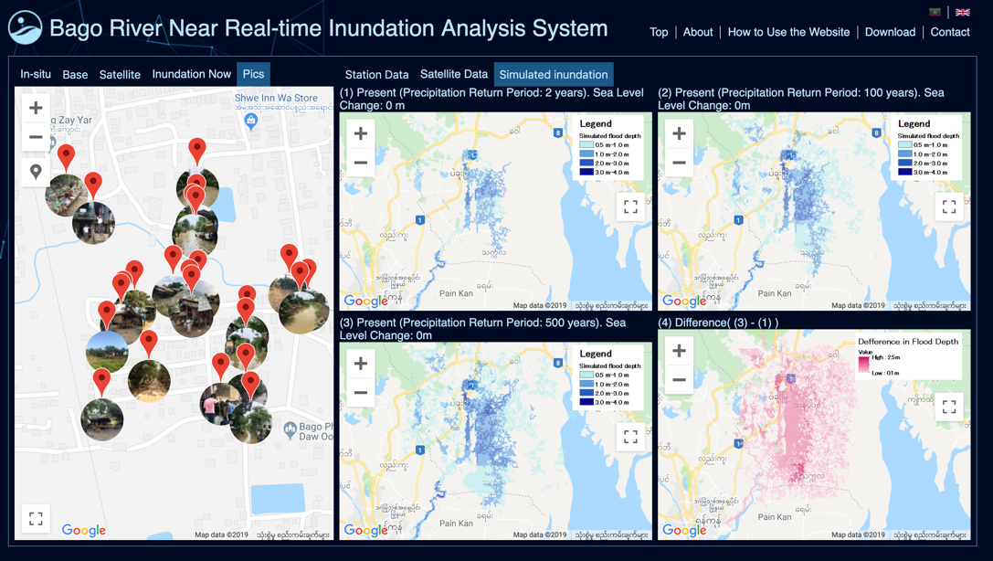
In order to address flood disaster risk reduction in a data scarce region such as Myanmar, a near real-time inundation analysis system was developed with the utilization of geospatial technologies. The System was just launched in this July to support the decision making of disaster risk reduction, and now it is in the process of test operation by Myanmar government during the rainy season of the country. Assumed inundation areas considering tidal effect are calculated in a near-realtime basis by integrating realtime hydrometeorological data on site, satellite rainfall product and Rainfall-Runoff-Inundation (RRI) model. DIAS (Data Integration and Analysis System), a platform for collecting and filing data from satellites, ground observation stations, numerical weather prediction models and climate change projection models, is used for the system development.
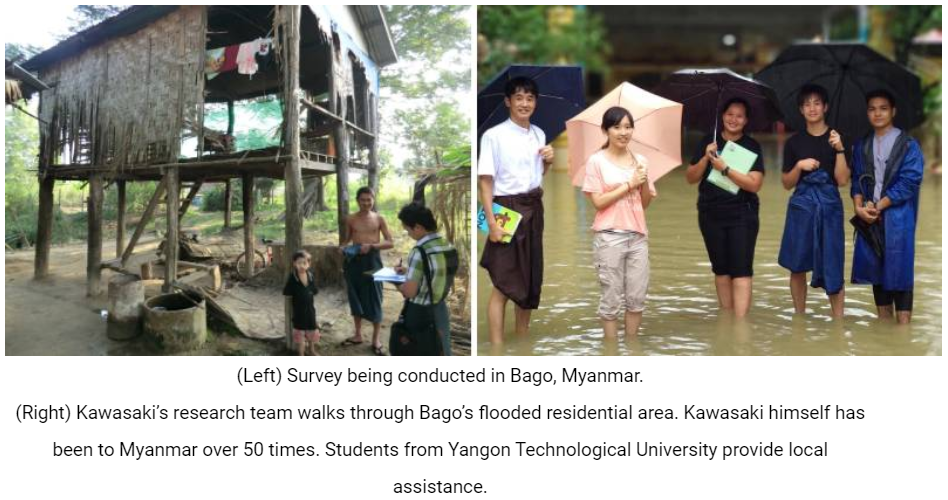
Also, socio-economic impact of floods to local residents was investigated through household interview survey (HIS) and inundation simulation. We found that poor people tend to live in flood-prone areas, and those floods can cause and exacerbate poverty using multi-regression analysis and spatial analysis. Spatial distribution results show that the people who suffer most from floods are those who live in the worst conditions.
Moreover, a new method for estimating economic levels of houses using high-reso satellite imagery and HIS data has been developing with deep learning models. This method is expected to detect residential areas of poor people which was difficult to figure out in many developing countries and required to poverty reduction policy making and planning in disaster risk reduction, public health, and urban planning.
About the Speaker
Prof. Kawasaki’s current research focuses on water-related disaster risk and poverty reduction in Asian from interdisciplinary applications of engineering and social science approach. He is leading several interdisciplinary research projects in China, India, Myanmar, Sri Lanka and Thailand in collaboration with experts in various fields, such as economics, cultural anthropology, historiography, and informatics using GIS as a collaboration platform.
As a member of the Earth Observation Data Integration & Fusion Research Initiative (EDITORIA) of The University of Tokyo, he contributes to the development of the Data Integration and Analysis System (DIAS), a global environmental data platform supported by the Japanese Ministry of Education, Culture, Sports, Science and Technology (MEXT). He stayed at Harvard during 2008-2009 as a Visiting Scholar at Center for Geographic Analysis (CGA) and School of Engineering and Applied Sciences, and will again stay at CGA from Aug. 2019 to Jul. 2020.