


A Behavioral Census of US Cities Using GPS Mobility Data
Date and Time
Location
Presentation by Hamish Gibbs, MIT and Northeastern University
Abstract: Cities are often described using census data, which characterize neighborhoods using familiar measures such as income, age, ethnicity, employment, and education. However, these measures tell us relatively little about how people organize their lives in cities: where they go, when they travel, and which activities they choose. This talk explores the behavioral structure of cities as a complement to traditional demographic measures. It begins with a discussion of the opportunities and limitations of large-scale GPS data for measuring population-scale mobility behavior. It then describes the process of building a 'Behavioral Census' from passively collected GPS data, identifying interpretable patterns of amenity access, travel distance, and activity timing across more than 350 metropolitan areas in the United States. Finally, it introduces ongoing research seeking to understand how mobility behavior is shaped by individual preferences and the opportunities and constraints of the built environment.
Bio: Hamish Gibbs is a Postdoctoral Fellow at the MIT Senseable City Lab and an Affiliate Research Scientist at Northeastern University's Network Science Institute. His research uses large-scale mobility data to understand how people move, interact, and access opportunities in cities, with a particular interest in urban inequality, privacy, and the reliability of behavioral data. Previously, he was a postdoctoral researcher at Northeastern University and worked as a Research Assistant studying human mobility and infectious disease dynamics at the London School of Hygiene and Tropical Medicine. He received his PhD in Geography from University College London, where he studied bias and uncertainty in mobility data.

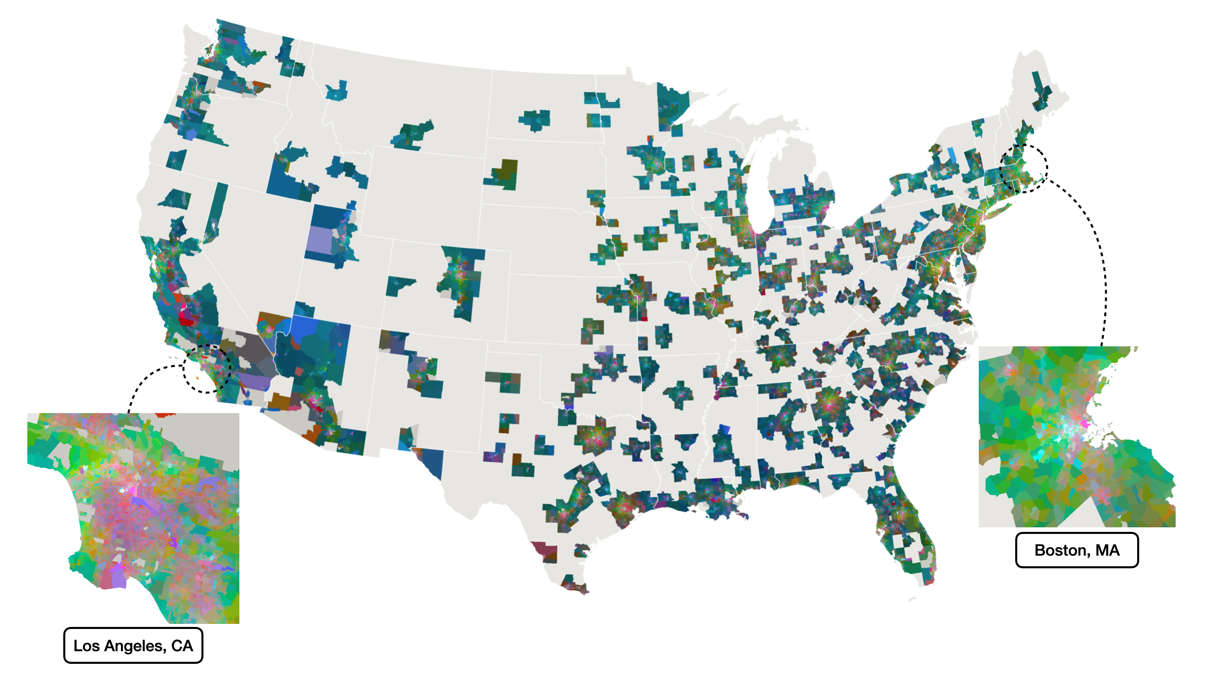
Image Description: False-color composite of census tract-level behavioral profiles across metropolitan areas in the United States, with detailed views of Los Angeles and Boston.