Mangrove Forests Mapping
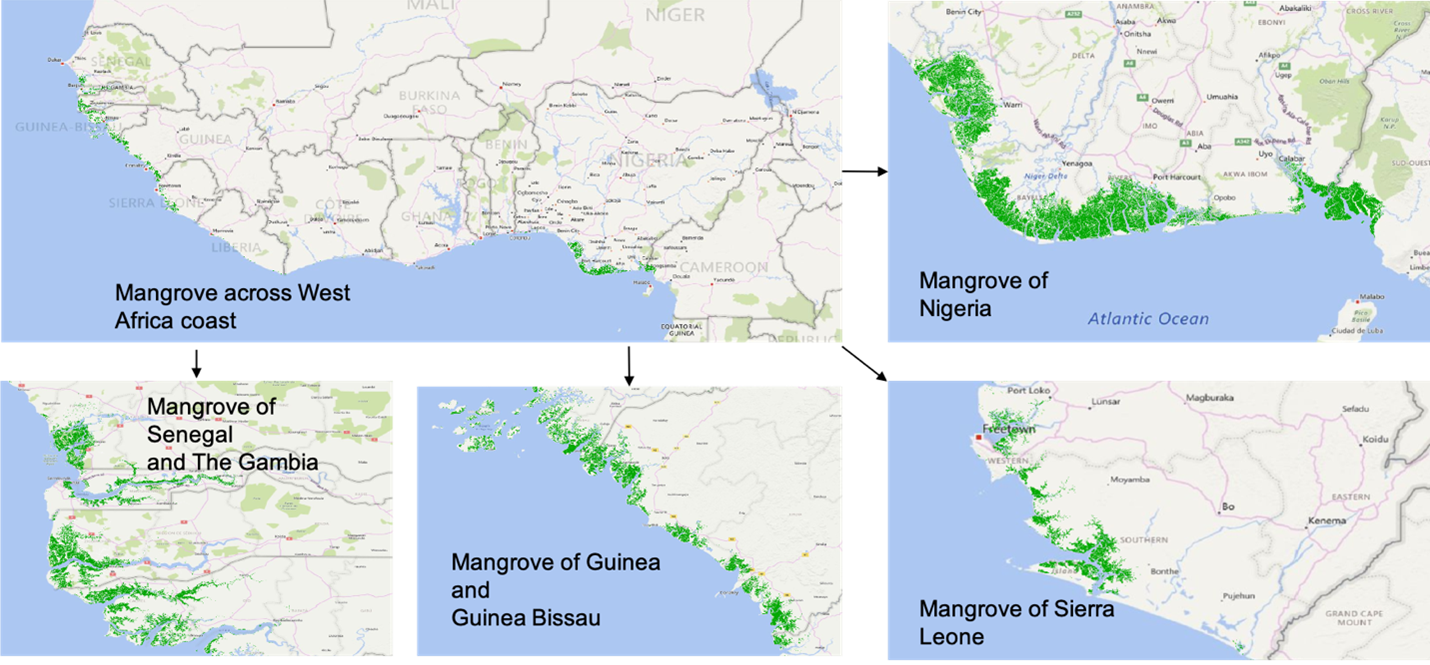
Coastal mangrove forests provide important ecosystem goods and services, including carbon sequestration, biodiversity conservation, and hazard mitigation. However, they are being destroyed at an alarming rate by human activities. To characterize mangrove forest changes, evaluate their impacts, and support relevant protection and restoration decision making, accurate and up-to-date mangrove forests mapping at large spatial scales is essential. Sponsored by NASA Carbon Monitoring Systems (CMS) Program, we developed a machine learning ensemble to map mangrove forests at 20 m spatial resolution across West Africa and Southeast Asia using Sentinel-2 (optical) and Sentinel-1 (radar) imagery. The cloud-based big geospatial data processing platform Google Earth Engine (GEE) was used for pre-processing Sentinel-2 and Sentinel-1 data. Extensive validation has demonstrated that the machine learning ensemble can generate mangrove extent maps at high accuracies (West Africa: 92%–99% Producer’s Accuracy, 98%–100% User’s Accuracy, 95%–99% Overall Accuracy). This is the first-time that mangrove extent has been mapped at a 20 m spatial resolution across West Africa. The machine learning ensemble has the potential to be applied to other regions of the world and is therefore capable of producing high-resolution mangrove extent maps at global scales periodically.
Peer-reviwed publication: Large-Scale High-Resolution Coastal Mangrove Forests Mapping Across West Africa With Machine Learning Ensemble and Satellite Big Data